Sandtable
SANDTABLE is an Interactive Combat Mapping Solution
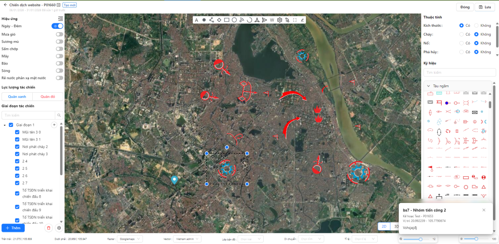
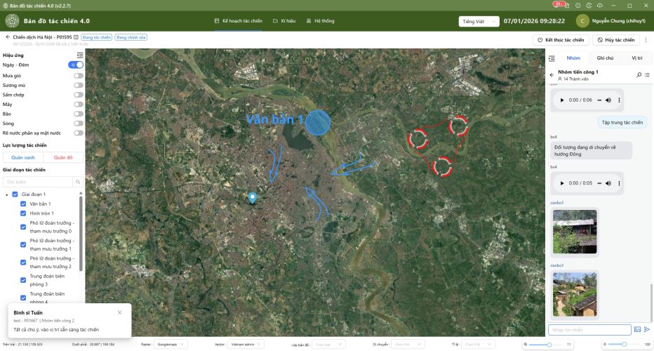
The SandTable is a real-time command and control tool that visualizes terrain, unit positions, and mission activities on an interactive digital map. It enables fast updates, situational analysis, and effective decision-making for both training and operational missions.
Sandtable: Precision Command. Instant Action. Total Control.

Digital Sandtable App 4.0
In the high-stakes environment of complex tactical missions, even the slightest discrepancy in information between the command center and field personnel can lead to catastrophic failures and strategic setbacks. The ‘fog of war’ often stems from a lack of synchronicity, where decision-makers and boots-on-the-ground are not seeing the same reality. To mitigate these risks, it is essential to have a system where every order is transmitted instantaneously and every visual from the field is streamed in real-time. This critical need for a unified, live operating picture is precisely why Sandtable was engineered—to bridge the gap between strategy and execution.
CORE ECOSYSTEM: THE POWER OF SANDTABLE
The Intelligent Command Hub
(PC Version)
Strategic Vision. Decisive Action.
(PC Version)
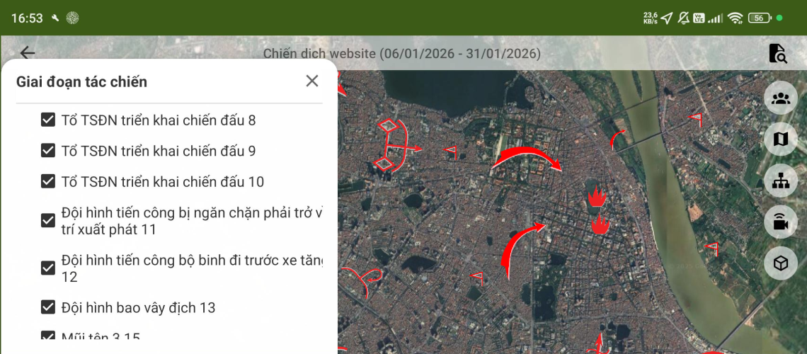
Agile Field Operations
(Android Version)
Strategic Vision. Decisive Action.
(Android Version)
The "Golden" Feature: Real-Time Field Intelligence
Unmatched Mobility. Seamless Connectivity.
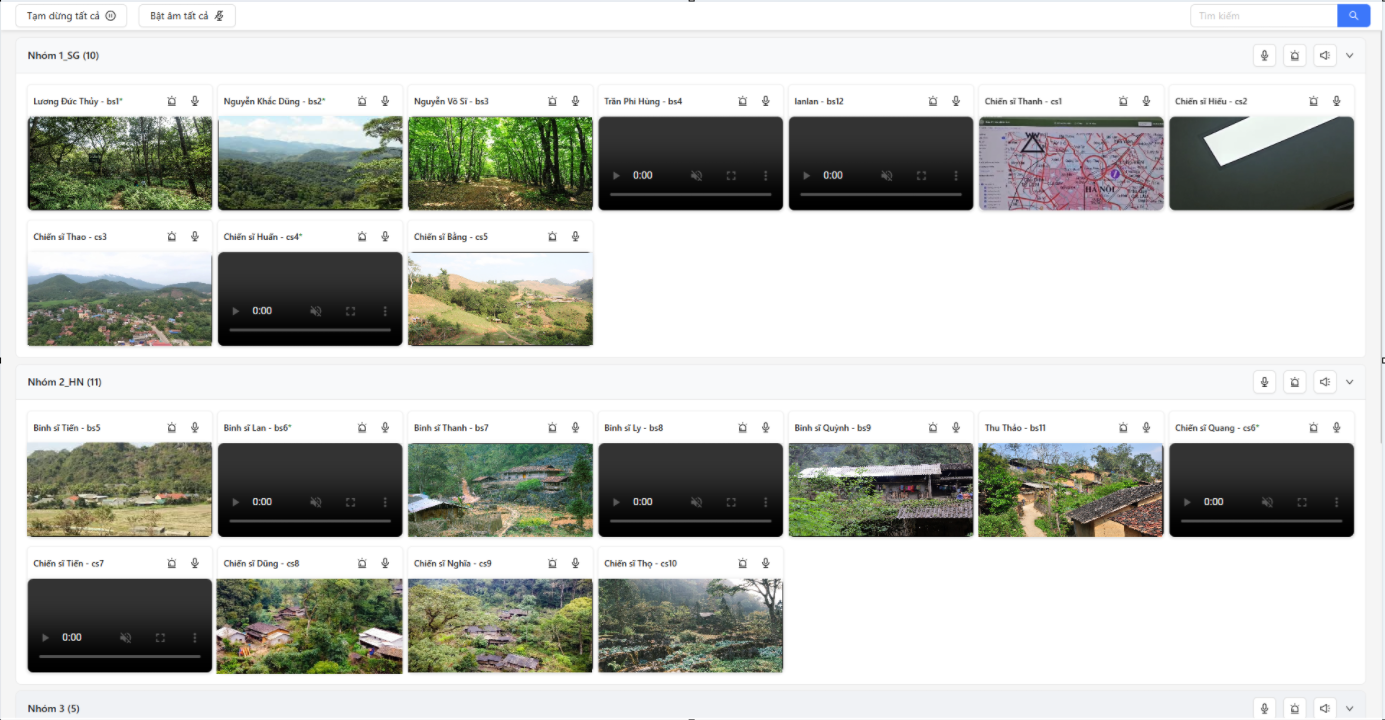
Beyond Traditional Reporting: Live Intelligence & Remote Command. In high-stakes environments, seeing is believing and reacting is winning. Our platform eliminates the gap between the field and the command center by transforming raw visual data into a powerful, real-time decision-making ecosystem:
Live Tactical Streaming: The Command Hub doesn’t just see one screen; it can aggregate live video from multiple field operatives simultaneously, creating a “Composite Surveillance Wall.”
Remote Guidance: Based on live visuals, a commander can instantly modify a task on their PC. Within seconds, the operative’s Android device vibrates with a new mission update, ensuring the unit is always responsive to changing conditions.
Uninterrupted Connectivity: Real-Time Tactical Messaging
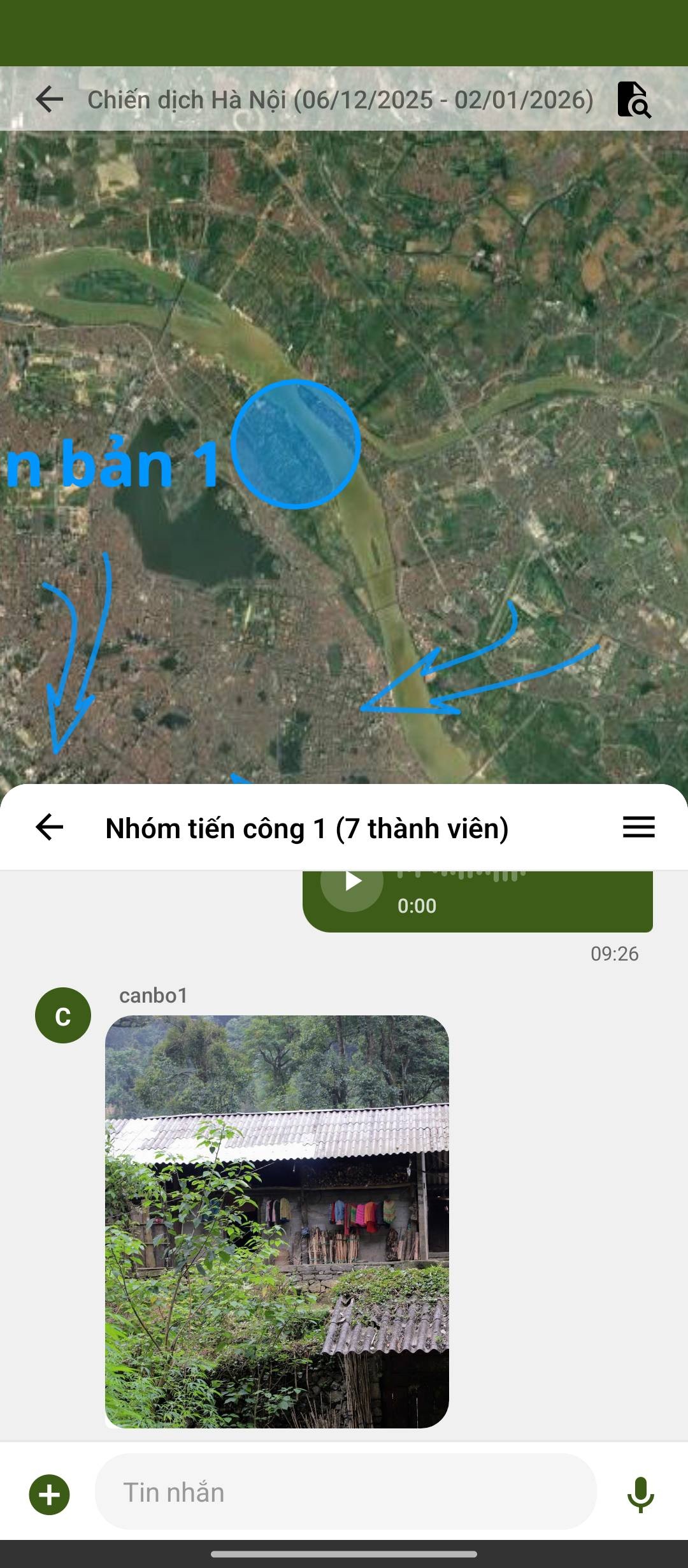
In high-stakes environments, the speed and security of your communication can be the deciding factor between mission success and failure. Our platform provides a robust, fail-safe link that keeps your entire unit synchronized via these critical communication pillars:
– High-Priority Background Alerts: Never miss a command. Our advanced notification engine ensures that every message reaches you instantly, even if the app is minimized or your device is locked.
– Instant Command Distribution: Synchronize your entire team in milliseconds, ensuring that every field operative and commander is always on the same page.